 First of all, there is no 911 in Italy. There is 113. There are other emergency numbers too, but there is also a language problem. Also, the word for HELP is Aiuto! (AYE-oo-tow). When you're in a traffic accident, or in the middle of a medical crisis, it's often difficult to say things correctly in English, no less in another language. I remember one time when calling 911 for a small fire in our house, I stumbled over the address a few seconds. It can happen to all of us.... so when traveling in Italy or especially when planning an extended stay there, a little emergency planning is well worth the effort. First off, here is a list of emergency numbers. I suggest programming them into your mobile phone before leaving for Italy, with a description of each. Or simply create a list and print it on a business card to place in your wallet. Useful Numbers in Case of Emergencies
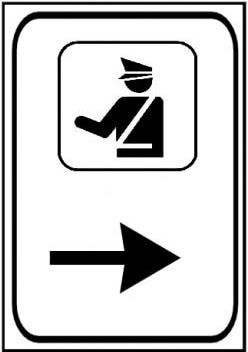
Who You Are Dealing With: Polizia or Caribinieri?
The Fire Brigades The Vigili del Fuoco, literally the Firewatchers, (official name Corpo nazionale dei vigili del fuoco or CNVVF), Italy's institutional agency for fire and rescue service. As a national service it is under the oversight of the Ministry of the Interior. Much of Italy (depending on which region you are in, and what deal they have with Rome) have nationally funded fire brigades. There are also volunteer fire fighters at the local level. In general, in case of fire, call 113 to report a fire and say: "Vi è un incendio _say the address_" ("There is a fire at _address_", Click the link then click the speaker icon for pronunciation). Ambulances/EMS Calls 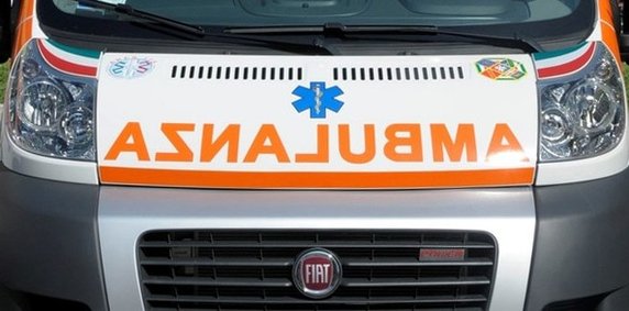 Emergency medical services in Italy consist primarily of volunteer organizations providing ambulance servicea, and by physicians and nurses who perform all advanced life support procedures. The emergency telephone number for emergency medical service in Italy is 118. Emergency medical services are under Public Health Authorities control in each Italian Region; the ambulance subsystem is provided by a variety of different sources. The method of delivery can vary considerably from one location to another. In some locations, responsibility for the provision of EMS has been undertaken by the local hospital, while in others, services may be provided by a range of volunteer organizations, such as the Italian Red Cross (Croce Rossa Italiana), ANPAS (National Association for Public Assistance), Confraternite di Misericordia, other associations commonly known as "Cross" (Croce), usually followed by a color (White Cross, Green Cross, Yellow Cross...), or by private companies.
In a life-threatening emergency, such as a heart attack or serious accident, call the free public first-aid number 118. State clearly where you’re calling from and the nature of the emergency, and give your name and the telephone number from where you’re calling. Don’t hang up until the operator asks you to. The appropriate emergency service is sent to you. Provided you call in response to a genuine emergency, you won’t be charged for the use of the emergency services. Two basic phrases to say: "Ho bisogno di aiuto medico!" ("I need medical help!" Click the link, then click the speaker icon to hear the pronunciation). "Sto male, aiuto!" ("I am hurt, help!" Clink the link then click the speaker to hear it spoken) Spelling on the Phone in Italy  In Italy there is some help, albeit a bit confusing and new to the American traveler. When spelling on the phone in Italy they use the alfabeto fonetico—the Italian phonetic alphabet. It is similar to the U.S. military method of spelling.... such as, "Alpha, Bravo, Charlie" (A B C), or when speaking to company service representatives to avoid miscommunication when speaking on the phone. The only thing is, Italians use names of Italian cities--some you might not have heard of--Ancona, Bologna, Catania, etc. To spell my last name, I would say "Firenze, Imola, Napoli, Zara, Imola"... F I N Z I. Alfabeto Fonetico: A come Ancona B come Bologna (or Bari or Brescia) C come Catania (or Como) D come Domodossola E come Empoli (or Enna) F come Firenze G come Genova H come Hotel (acca) I come Imola J (gei or i lunga) come jolly (the joker in Italian card games) (or Jugoslavia) K (kappa) come Kursaal L come Livorno M come Milano N come Napoli O come Otranto P come Palermo (or Padova or Pisa) Q come Quaderno R come Roma S come Savona (Sassari or Siena) T come Torino (Taranto) U come Udine V come Venezia (Verona) W (vi/vu doppio) come Washington (Wagner) X (ics) come Xanto (xilofono) Y come ipsilon (York or yacht) Z come Zara (Zurigo or zeta) Or, believe it or not, an easier way is to simply practice saying the Italian alphabet... the way the Italians do. Learn it. Sure it will take a little practice, but it's very helpful when in Italy. I had to spell my name several times when I was there and never resorted to the military style above. Really try to say each letter with an Italian accent. Here is an excellent video which will teach you not only about how to say the names of letters in Italian, but will teach you what sounds the letters make when used in words: Words and Phrases
And for more, here is a link to a more comprehensive list of phrases to use in emergencies... So, there you have it, a little primer on how to call for help in Italy. I hope and pray you won't even need this stuff, but it pays to be prepared (and I was never a Boy Scout!). Rimanga sicuro... Stay Safe! --Jerry Finzi If you found this post useful, please SHARE it on your favorite Facebook pages... Grazie! Copyright, Jerry Finzi/Grand Voyage Italy, 2017 - All Rights Reserved
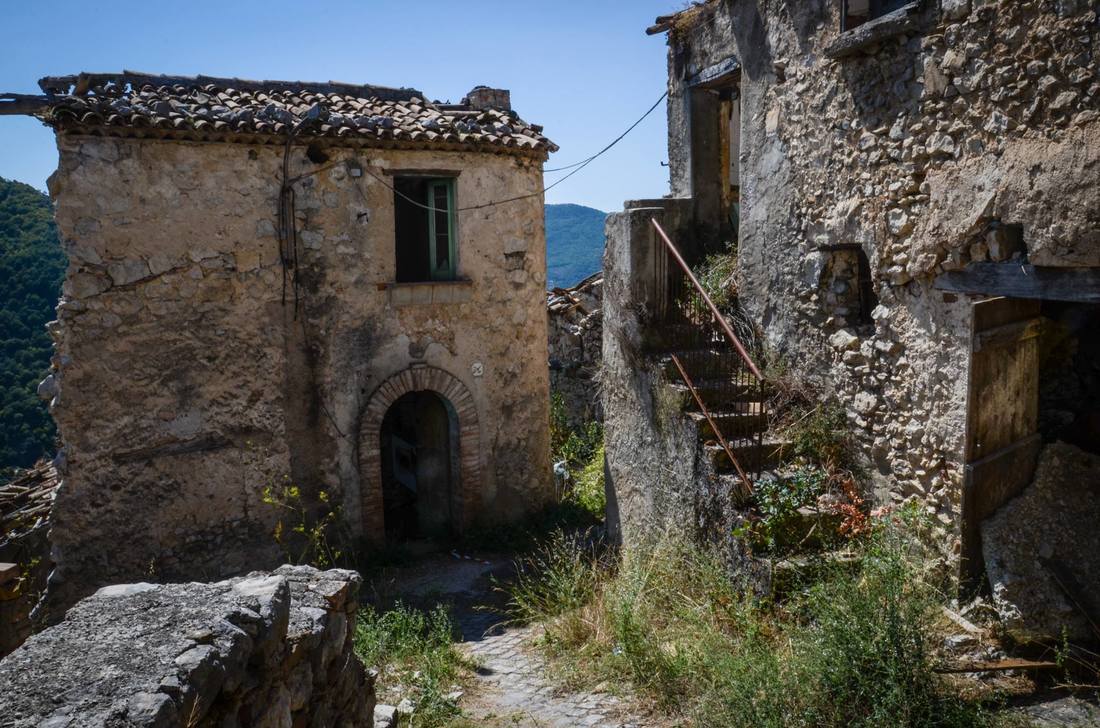
Borghi Fantasma (Ghost Towns) of the Cilento The obvious thing that you notice when touring through Italy is its geology. The mountains, cliffs and hills are mostly a direct result of volcanic action--and in addition, there are three active volcanoes still terra-forming the landscape. The weather is also a factor with most of Italy experiencing a "rainy season" beginning in late October. When heavy rains come, there are floods and landslides. Earthquakes are a regular occurrence throughout Italy, too. All these can be disastrous for communities--enough so that they must abandon their homes. Aside from the weather, there have been many other factors causing towns to be abandoned throughout Italian history: harsh living conditions, plague, lack of running water and electricity, failure of crops, pirate raids, bombings and even the massive emigration to the Americas for people striving for a better life for their families. In fact, some put the number of Ghost Towns in Italy at nearly 20,000! Many of these are wonderful snapshots in time ripe for the Slow Travel Voyager to discover. The Cilento has been affected by some of these factors causing communities to abandon their homes--while creating some interesting Borghi Fantasma, Ghost Towns... 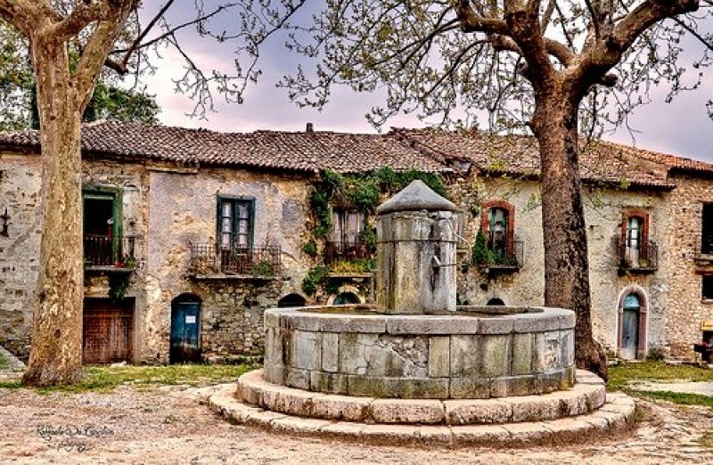 Roscigno Vecchia's fountain
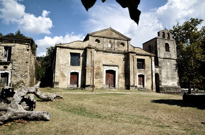
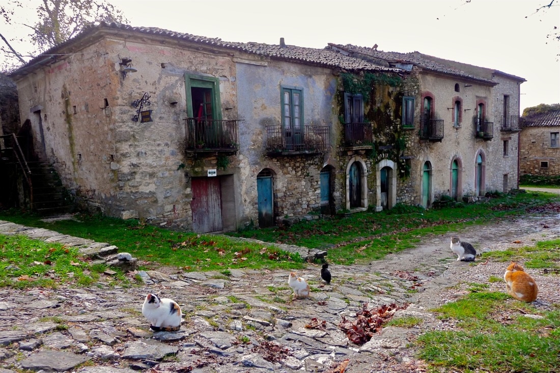
Romagnano al Monte 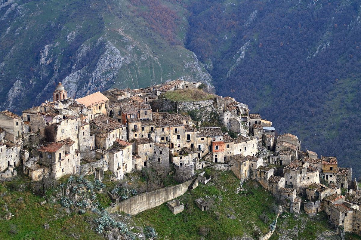 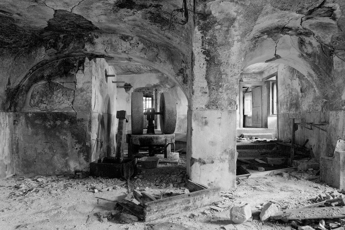 The remains of everyday life are in many buildings in the village The remains of everyday life are in many buildings in the village A sixty mile drive miles from Roscigno Vecchia will bring you to the ghost town of Romagnano al Monte, right on the border of Basilicata. It has a long history from the late Roman era over 1000 years ago with kings, lords, barons, brigands, and heads of murderers displayed in the piazza. After a 1980 earthquake the 600 inhabitants were relocated to a new Romagnano nearby. When I visited the site in 2014 access was restricted with a rehabilitation project underway to promote tourism. Tourists are welcomed today. The village sits 1300 feet above the Platano river canyon below and boasts two fortified religious buildings dating from the 13th century with the walls of a castle still evident. Many houses still stand, some in near perfect condition but most others severely damaged by the earthquake with nature taking over. Kitchens may still have dishes and pots, with other rooms showing little glimpses of the lives that prospered here... a doll's head, prayer icon, furniture, tools or even shoes. Click to see MAP.
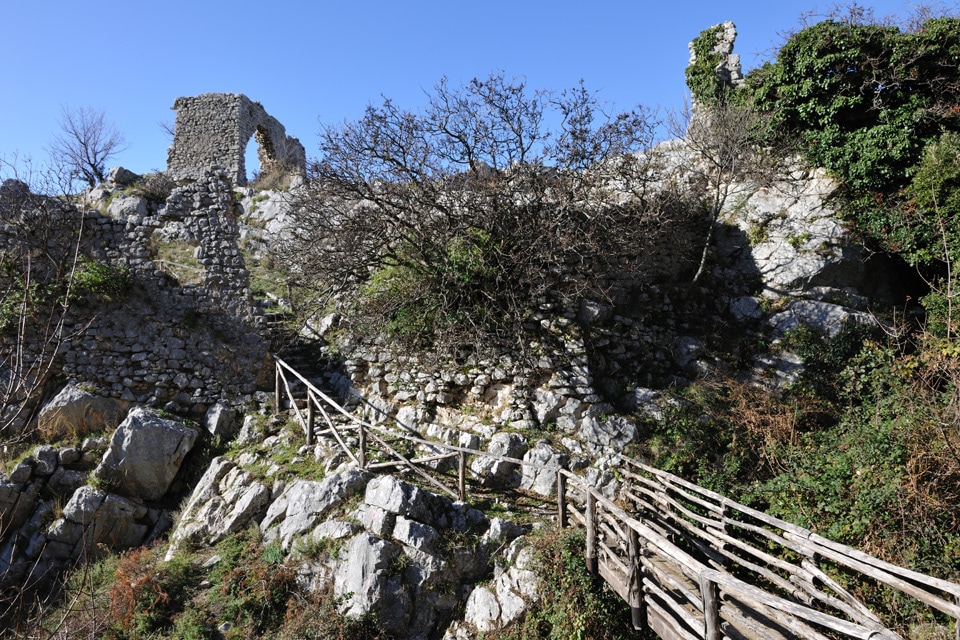
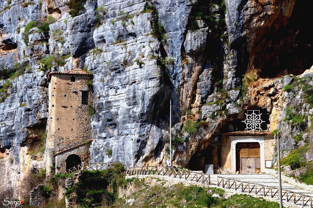
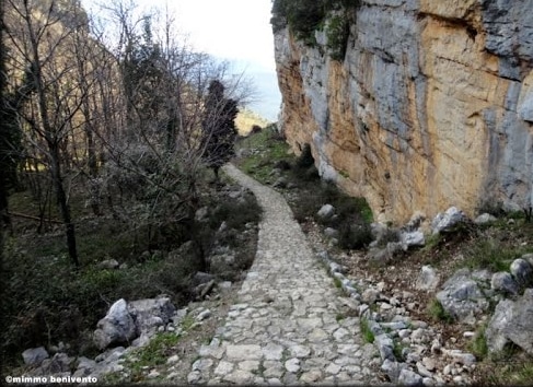
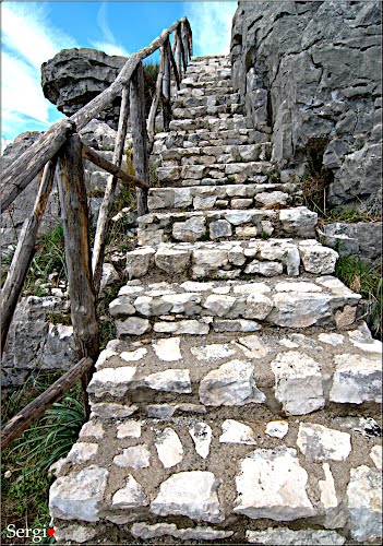
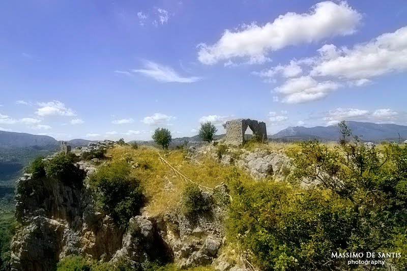
Borgo Medioevale di San Severino 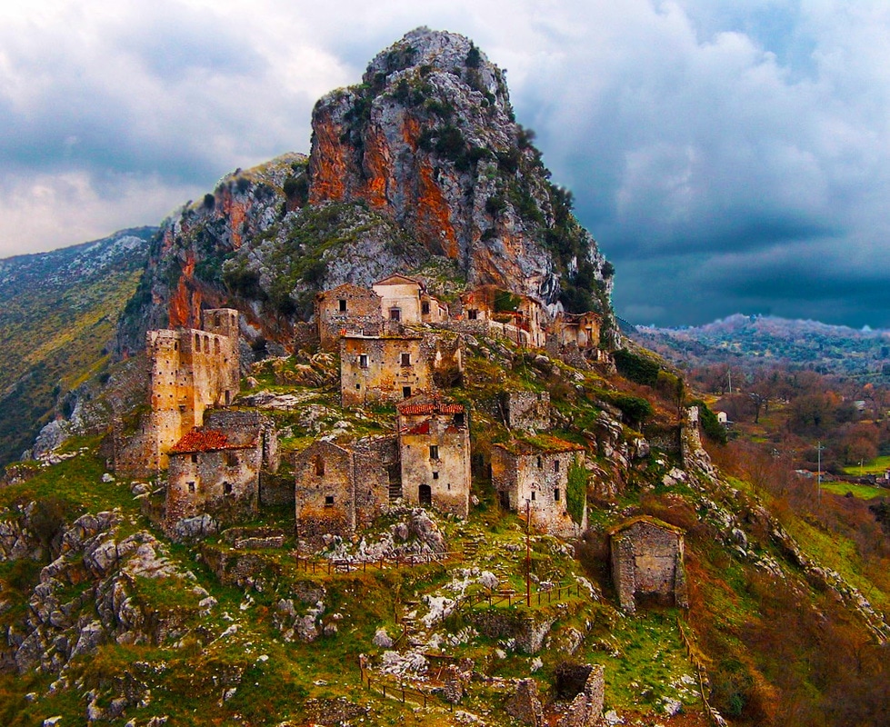 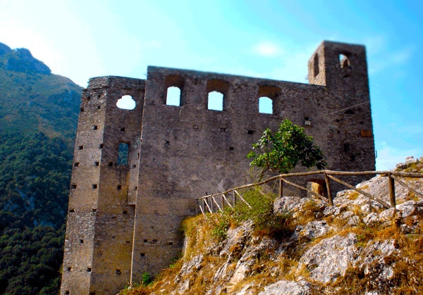 Il Castello Il Castello Perched just above the modern village of San Severino di Centola is a medieval ghost town that was abandoned decades ago, when the inhabitants decided they would like to live closer to the new railroad station. A thousand years ago, a castle and watch tower were built to protect against invaders from the Gola del Diavalo (Devil's Gorge) below. The ruins of the castle are still there to explore along with the ruins of the Church of Santa Maria degli Angeli and other homes in the village. In August a festival is held in the Borgo and a living creche during the Christmas season. Click for MAP. 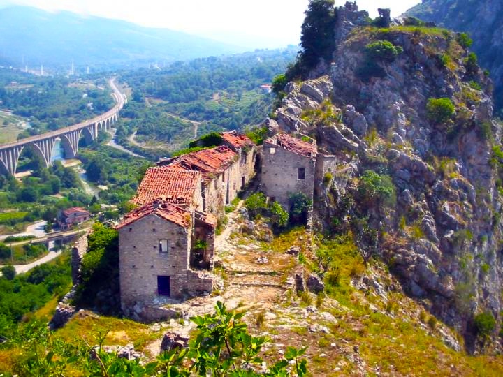 Sacco Vecchio  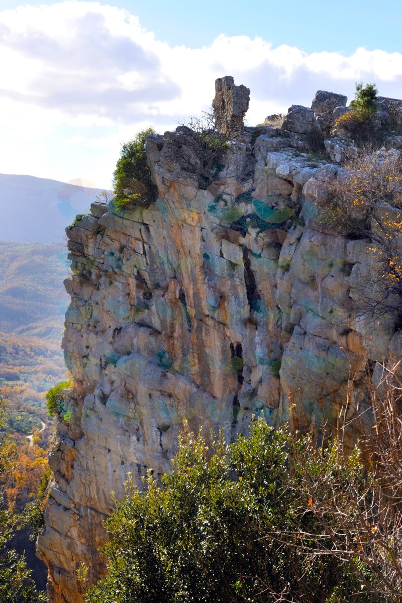 Ruins of Sacco sit on top of a dramatic precipice Ruins of Sacco sit on top of a dramatic precipice Sacco Vecchio is a different type of ghost town, having been abandoned for unknown reasons between the 9th and 11th centuries AD, possibly due to either plague or invasion by brigands or other foreign forces. Sacco Vecchio was abandoned by its inhabitants who moved more downstream at the foot of Monte Motola. Today, visitors can hike up some very well maintained rustic steps to the ruins of the old village (about 3/4 mile walk from the modern village of Sacco), looking more like an ancient archeological site than other ghost towns abandoned in more recent times. From the 4th century, the area was settled by the Longobards and Basilic monks. There are also structures and foundations that have been dated to pre-Christian times.
  Sorgenti del Sammaro Sorgenti del Sammaro Some ghost towns come with legends and Sacco Vecchio is one of them... According to an 18th century legend, the castle on top of the cliff was built around 600 AD by Duke Zottone di Benevento, to ward off the Byzantines. The overly jealous and possessive Duke accused his wife Saccia of adultery and locked her away in the castle. After the destruction of the castle in the 8th century, the inhabitants built their new village downhill called it Saccia in memory of the Duke's innocent wife. The site is situate on top of a 400 foot tall cliff with sheer rock walls over 200 feet tall. There are many hiking trails in the area and the gorge below --the Sorgenti del Sammaro (Sammaro Springs Gorge)--that will take you to amazing rock formations shaped by the torrents flowing through the gorge. The nearby modern village of Sacco is also very picturesque and worth a visit with its narrow streets, flowered balconies and the cliffs towering above. Don't forget to visit their museum of wood artisan crafts. Click to see Map. Grottoes and Caverns of Cilento 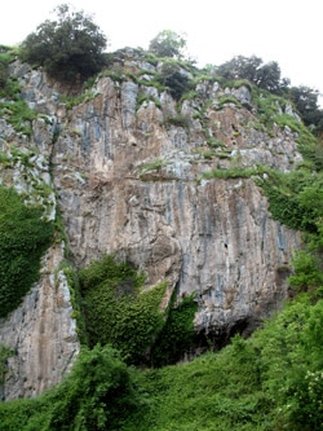 Entrance to the Grotte is just behind the greenery Entrance to the Grotte is just behind the greenery Grotte di Polla Explored in 1956 by some the Grotte di Polla contains concretions of stalactites and stalagmites, but still retains a deep layer of mud on the bottom that makes things difficult for speleological explorers to explore further. How to get there: cross the village of Polla, and follow the signs for the Convent of Sant'Antonio. One quarter of the way up Via del Convent di Sant'Antonio on a sharp curve you will find the entrance to the Grotte up a short path hidden by some vegetation. At this writing, it is not clear about how to gain access to the Grotte di Polla. It's best to contact the Commune of Polla. This video shows a 3-D plotted animation tour of the Grotte di Polla. La grotta di San Michele Arcangelo 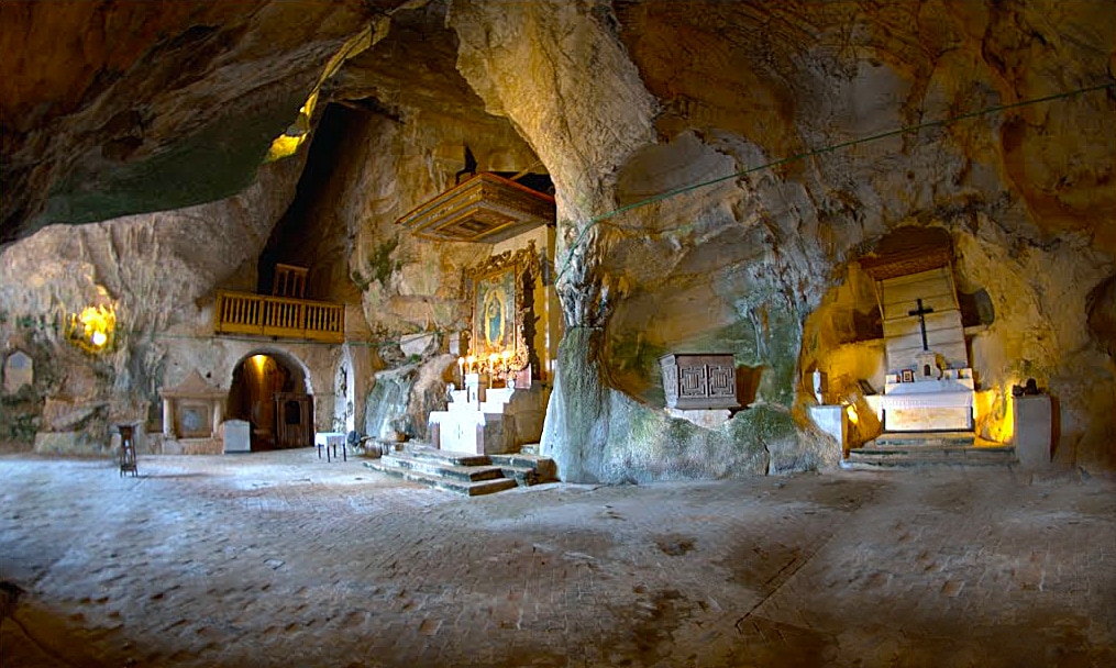
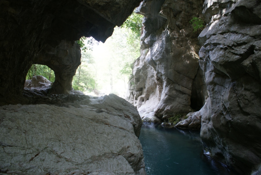
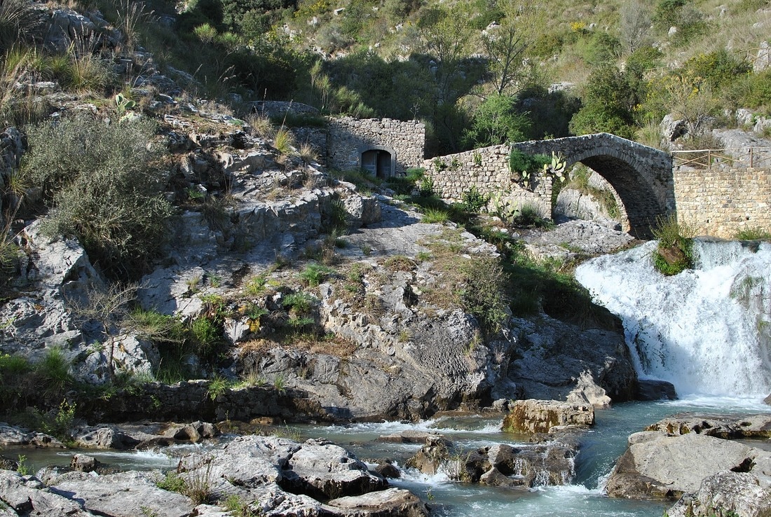
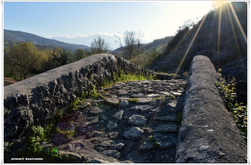
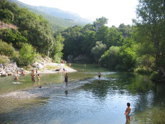
 Bell tower and entrance to Grotta di San Michele  "Antece" - il Guerriero di Costa Palomba "Antece" - il Guerriero di Costa Palomba Another interesting discovery in Fasanella is found 2000 feet up above the town--"Antece" - il Guerriero di Costa Palomba ("Antece", the Warrior of Costa Palomba)--a rock sculpture dating back to the 4th century BC. The ancient warrior's name is "Antecce" (in local dialect), which can be translated as either "The Ancient" or "The Immovable". He is life-sized and dressed in a warrior's tunic holding with a sword strapped to his back, a lance and a shield at his side. The road to the site is well marked from the village with a short, well kept path taking you by foot up to Antecce. 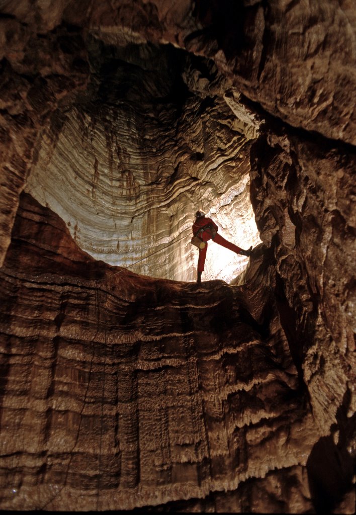 And for serious spelunkers, there is the Grava dei gatti Monti Alburni, a wonderful cave with a huge vertical sinkhole. Also up in these hills are found an observatory, several mountain chapels and sanctuaries, and stacked rock spires. It's definitely a mystical place to visit. The road to the cave (grotto) is immediately off of the main square in the town at the end of Via Primavera. The road leading up to Antecce is on the other end of town. 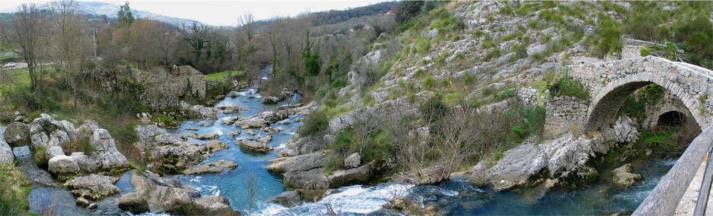 Auso and its Roman arched bridge 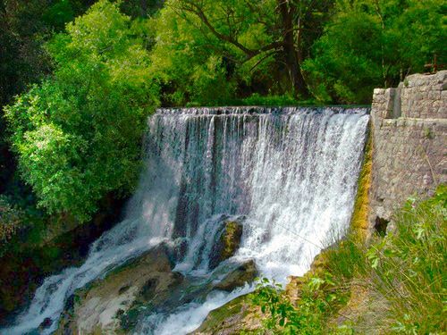 The falls from the containment pond at the top of the Auso spring The falls from the containment pond at the top of the Auso spring While in Sant'Angelo a Fasanella, there is one other site you should visit... Cascate dell'Auso, natural springs, a source pouring out of the mountain, with a series of waterfalls and its ancient Roman arch-top bridge. This is a well-cared for natural park site with walkways, bridges, ruins of old structures and overlooks. There is a 150 foot deep sinkhole directly on top of the 1000 foot cliff that rises just above the Auso spring source, evidence of the power of water in this Karst environment. Water is everywhere underground, slowly eroding the limestone with its acids, forming caves and occasional sinkholes. This is a great spot for photos, a comfortable walk and a picnic. Take a left turn at the entrance for the Grotta di San Michele Arcangelo to get to the Auso park, about 1 mile from town.
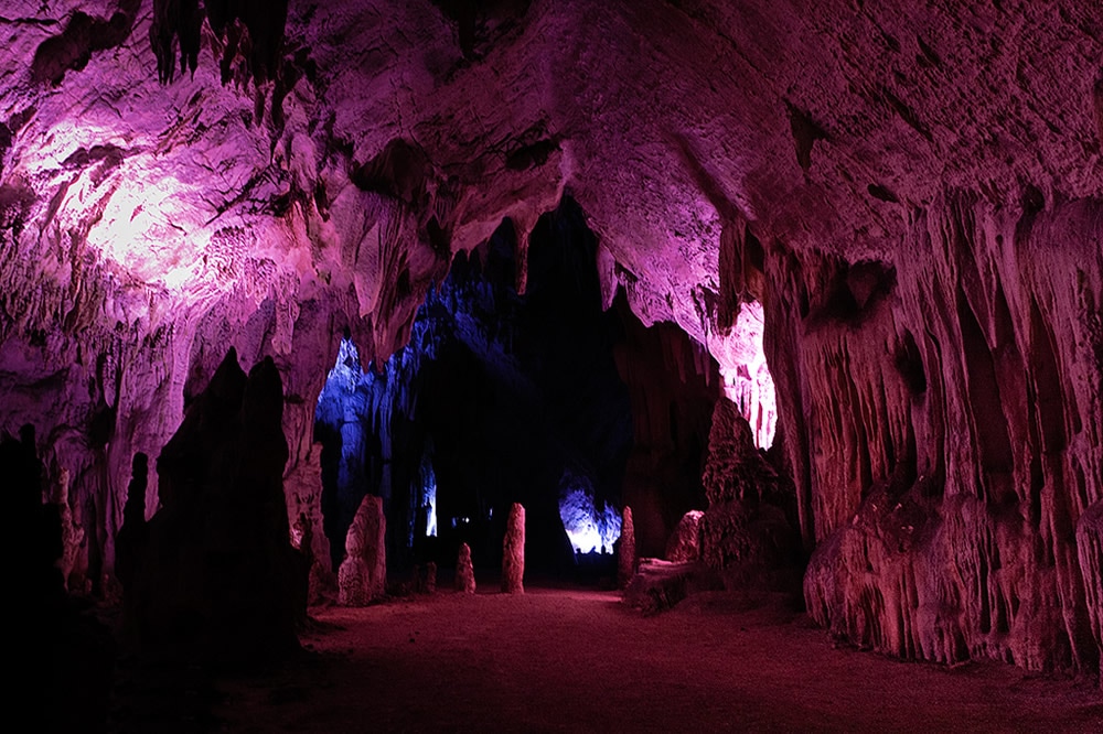
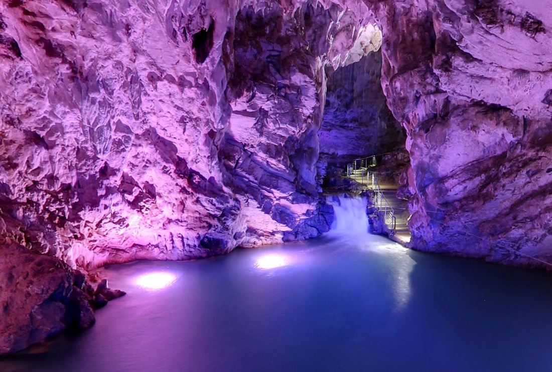
Grotte di Pertosa 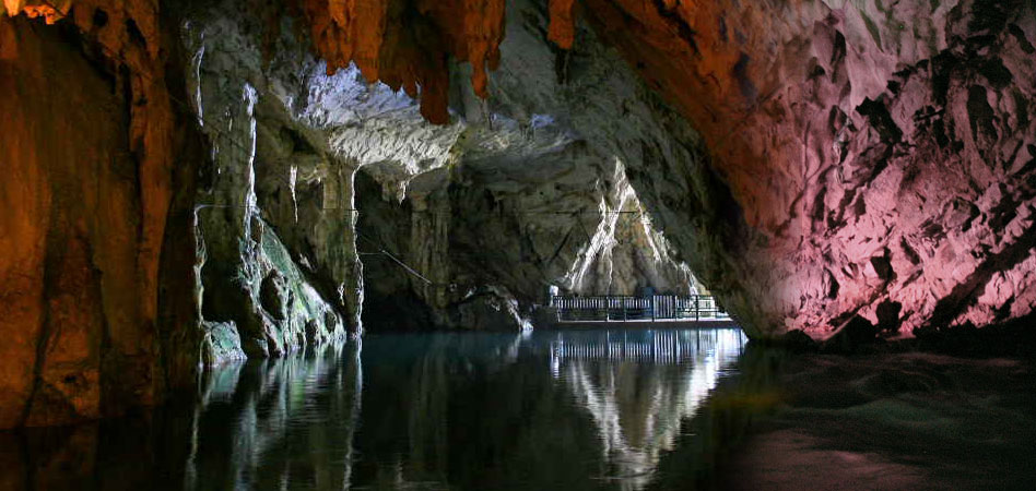 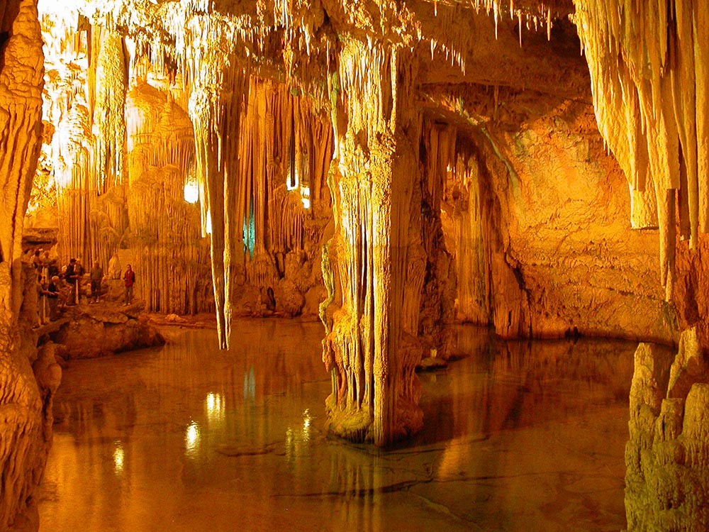 The Grotte di Pertosa are one of the best--and largest--caverns to visit in all of Italy (although the huge caverns at Castellana di Grotte in Puglia are my personal favorite). Only 40 minutes from Salerno at the northeast corner of the Monti Alburni massif (mostly highway) and about one hour 40 minutes from Agropoli (going around the mountains), they are the only caverns in Europe where you can navigate an underground river by boat. The Fiume Nero tour is mixed with silence, magnificent rock formations, occasionally interrupted by the roar of the underground waterfalls. The grottoes took Mother Nature 35 million years to form and stretch for nearly two miles under Alburni Mountains, rich with concretions, columns, "bacon"formations, stalactites and stalagmites of endless colors and sizes. One of the most popular grottoes in the region, they are often rented for receptions, weddings, film crews and even fashion shows. The temperature is 60 degrees Fahrenheit all year long. Click to see map.
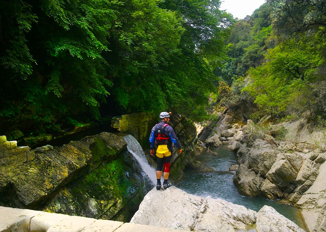 Canyoning in the Campostrino Gorge 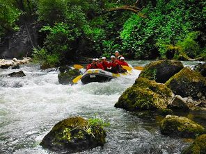 The tiny village of Pertosa seems very well groomed due to the tourist popularity of its Grotte, but there not much else to do there aside from filling up your gas tank and eating at one of the many tourist ristorante. But there is is one more attraction to the area... Less than a half mile south of Pertosa, the Campostrino Gorge runs from the nearby hamlet of Muraglione and the village of Auletta is a popular spot for river rafting, kayaking and canyoning. is a popular spot for river rafting, kayaking and canyoning. In fact, if you are into these sports, the entire region of Cilento is ripe with options due to the many rivers and gorges. Grotte di Castelcivita 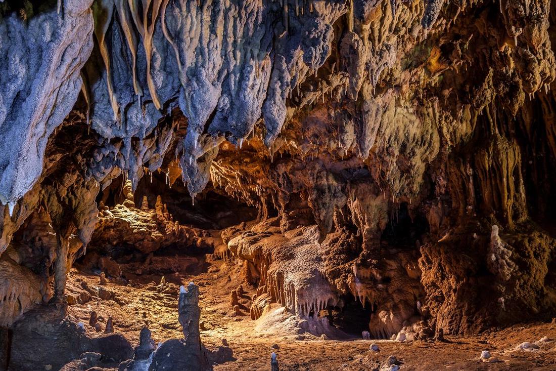 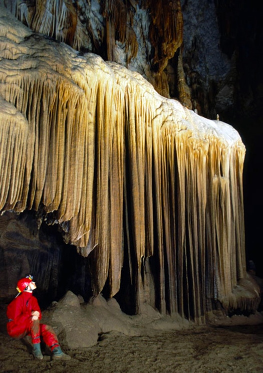 Lying just outside the Parco Nazionale del Cilento e Vallo di Diano, at the southwest edge of the Alburni massif, the Grotte di Castelcivita caves extend for 3 miles, making them one of the largest caverns in southern Italy. They offer one shorter trail for tourists (3/4 mile) and another 3 hour excursion (1-3/4 miles long) for amateur cavers. The grotte contain world class stalactites and stalagmites and other bizarre mineral formations. The entrance to the caves are situated about a mile downhill of the hilltown of Castelcivita. There is a small ristorante/pizzeria and outdoor stands with locals selling crafts like wood carvings and pottery, and local produce like honey or cheese. Another colorful bar tabacchi sits one hundred meters down the road with a sunny outdoor patio, drinks and food. The Grotte hosts many types of performances, too... multimedia, performance artists, concerts, etc. 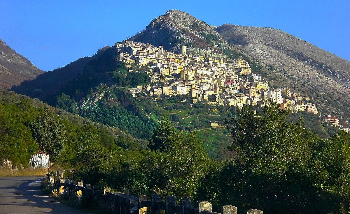 Town of Castevicita
As you can see, this brings us nearly back to where we started our tour of the Cilento in Paestum... a 45 minute drive from Castelcivita. Of course, there is so much to do in the Cilento that you can make your own itinerary depending on your interests and the time you have to spend there. The Cilento can be where you head toward after visiting Naples and the Amalfi Coast, or you can combine a trip through the Cilento on the way to points further south in Basilicata, Puglia, Calabria or Sicily. The more you explore southern Italy, the more wonderful things you'll discover... like the Cilento! I hope this three part series has helped. Buon viaggio! --Jerry Finzi Copyright 2017, Jerry Finzi/Grand Voyage Italy - All Rights Reserved
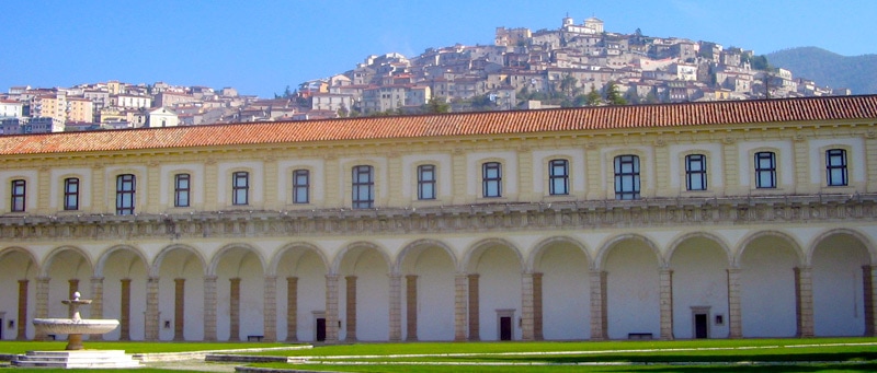
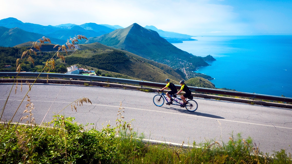
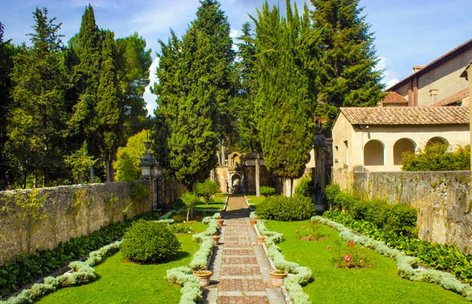
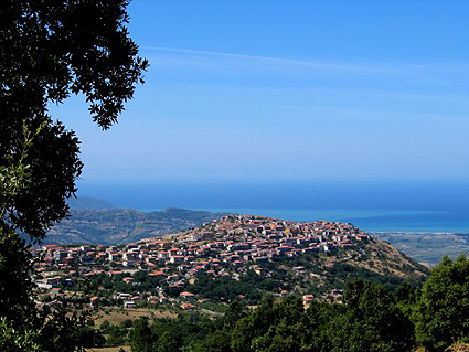
Vallo di Diano - The Inland Cilento Plateau 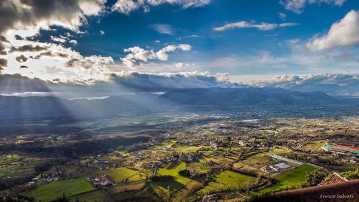 The complete name of the national park zone is Parco Nazionale del Cilento e Vallo di Diano (Cilento National Park and the Valley of Diana). There are really two parts to the park... the Cilento Coast with its seaside towns, beaches and the mountains, and inland, the Vallo di Diano. This broad valley ( 5 miles wide by 20 miles long) is naturalist's wonderland and can be a relaxing contrast to the beachy summertime holiday vibe of the coastal beach towns--especially during the high season. There are flowering meadows, dense forests, with the dramatic mountains feeding the many streams, rivers and waterfalls. A UNESCO Site, it is the second-largest national park in Italy, covering nearly 700 square miles and containing 80 villages. Besides the history of Greeks, Romans and others, during more modern history these mountains were plagued by roaming briganti (bandits). Today, you are safe from kidnapping or thievery--not to worry. If necessary, you can say your prayers at the largest monastery in Europe. One method of getting a good taste of both the coastal beaches and mountains as well as the Vallo di Diano is to start at Paestum, moving down the coast visiting the various towns and points of interest, then after exploring Capo Palinuro, make a turn up toward the mountains and the valley, heading north again, thus doing a sort of loop of the entire region. There are many discoveries to be made in the Vallo... 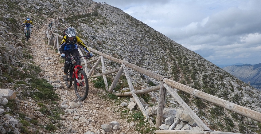 Cycling to Monte Cervati from Sanza 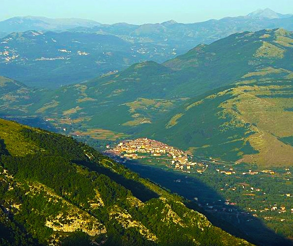 Sanzo, on its hilltop surrounded by mountains Sanzo, on its hilltop surrounded by mountains The hilltown of Sanza will be your first stop when traveling up from Palinuro toward the Vallo di Diano. While it does have an old historic center at the top of the village, the town can be thought of as a pit stop while traveling. As a workaday Italian town, it has gas stations, restaurants, alimentari (small food markets) and hardware stores... in other words, it's a place to stop to fill your tank and pick up picnic supplies. You might find its location fairly interesting, too, as it's surrounded by some pretty majestic mountains--for one, the extinct volcano Monte Cervati is over 6000 feet tall, the highest mountain in all of Campania.  No matter what level of climbing experience, Monte Cervati and the surrounding mountains have something for everyone 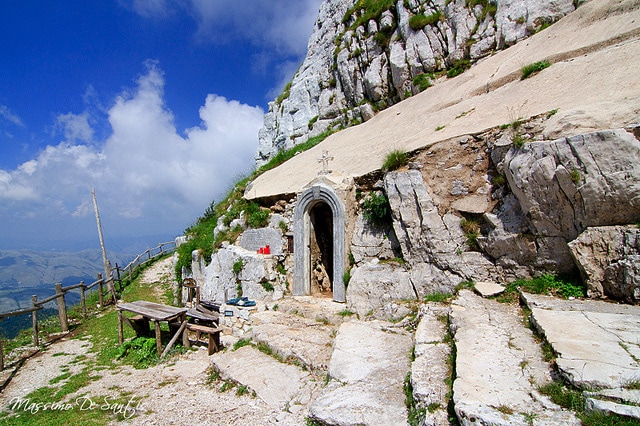 A hermitage and sanctuary dug into the rocks near the summit of Cervati A hermitage and sanctuary dug into the rocks near the summit of Cervati This area has a strong appeal for serious trekkers, mountain climbers or back country mountain bikers... there are several trail heads just before you reach the town. One dirt road travels up to a small mountain chapel pilgrimage about a mile west of the summit. Otherwise, there is a loop trail that starts at the north end of Sanza which is 35 miles long with an elevation challenge of nearly 5000 feet! If you are traveling with a 4 wheel drive vehicle, you can drive up toward Cervati and start your trek or cycling adventure from higher up the mountain. If you're into serious mountain cycling, this is the place for you. In winter, the place is well known for snowboarding. The views from the bald, rocky top of Cervati are amazing but during the journey you might come upon mountain goats, sheep, grazing buffalo, wild boar, wolves (yes, they have some here), hawks and eagles. The trails may also lead to waterfalls, majestic cliff overlooks, caves and even a tunnel or two. Note: Although you can drive fairly high on the mountain with a 4-wheeler, this is serious back country. Don't travel alone. Cell phone service is spotty. Mountain rescue is fairly non-existant. Bring a hand-held GPS unit if possible. Day trips only--do not consider camping on the bare-topped mountain. Carry lots of water. If you are into more flat land cycling and trekking, consider trekking in the valley below. 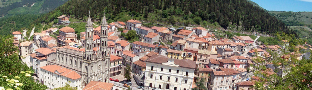 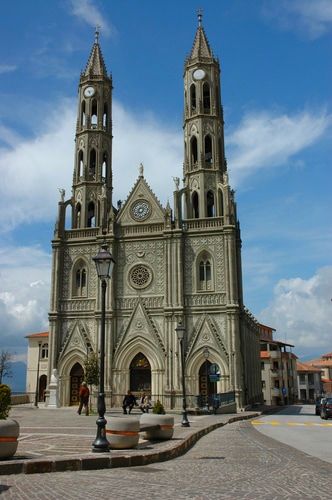 Montesano sulla Marcellana is another workaday hilltown about 8 miles further east on the other edge of the Vallo di Diano. You will find this one a bit more attractive in terms of architecture as this town has a history going back 1000 years with a varied cultural past during the Renaissance. It's an odd hilltown in that it's missing its castello or rocca at the top (Google Earth shows just a wide flat parking area, but there might be new construction going on at the time of this writing). Its obvious crowning glory is a rather late addition--Sant'Anna a Montesano, the twin-spired Gothic cathedral built in the 1950s with a grand exterior but a rather bland interior when compared to most other basilicas or cathedrals in Italy. If anything, this village is worth a visit if only to take in the wide panoramic views of the entire expanse of the Vallo surround by its mountains. Certosa di San Lorenzo Monastery 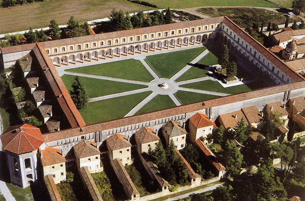 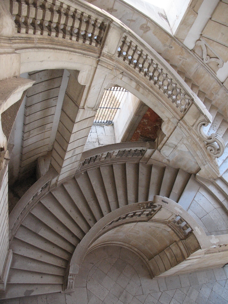 Sitting on the eastern edge of the Vallo di Diano, just below the hilltown of Padula, is a "monastery" claimed to be one of the largest in southern Europe... the Certosa di San Lorenzo. I put "monastery" in quotes for good reason. Looking more like an over-indulgent palazzo on the scale of Versailles rather than a stern, stark monastery, the Certosa dates from 1306 and covers nearly a square mile and contains: 320 rooms and halls, a mile and a half of corridors, galleries and hallways, 300 columns, 500 doors, 550 windows, 13 courtyards, 100 fireplaces, 52 stairways (some are magnificent) and 41 fountains. And I haven't even talked about the huge formal gardens. I can't imagine monks here spending much time meditating and praying in their cells. 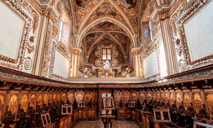
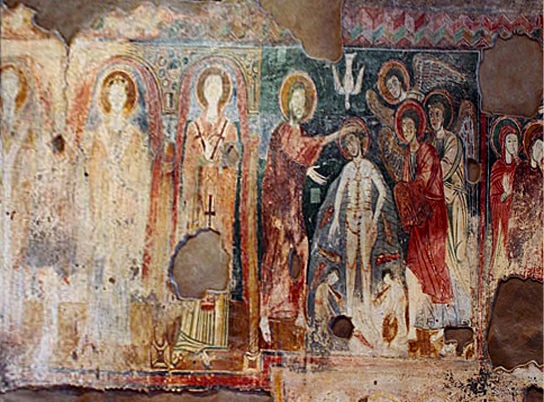
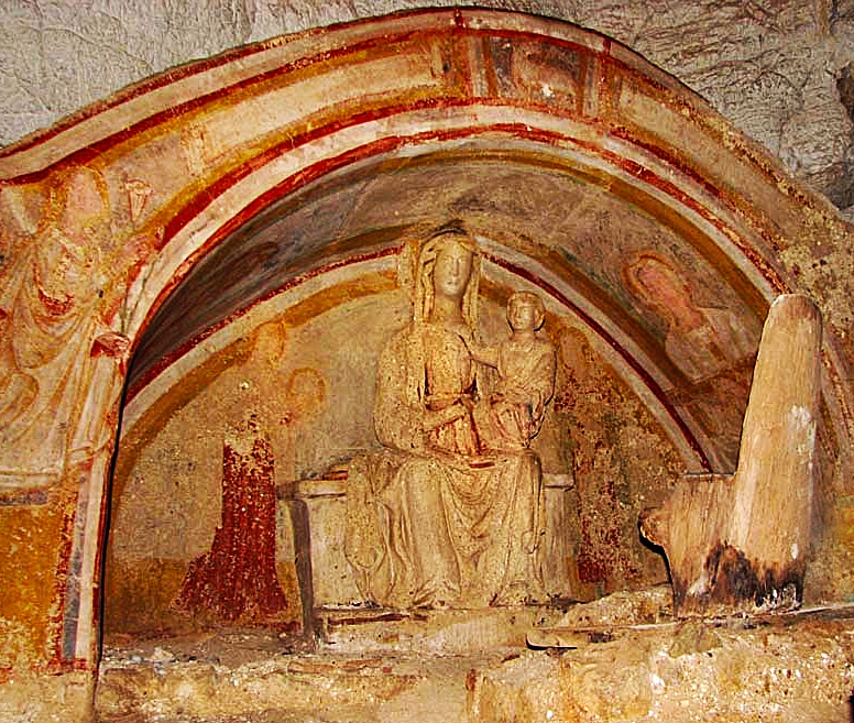
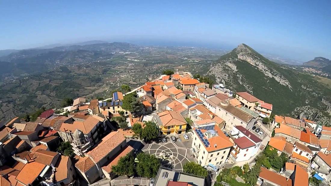
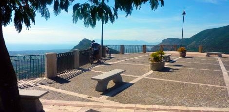
 The town of Padula on the hill above the cloisters As you can imagine, you can spend a lot of time trying to see everything at Certosa di San Lorenzo. If you would like to visit here, you might consider a stay in the little hilltown of Padula overlooking the monastery. The Certosa is one of the crowning highlights of a Voyage through the Vallo di Diano--don't miss it, but allow enough time to explore it fully. 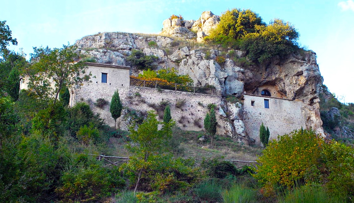 San Michele alle Grottelle While in Padula, there is one other site worth taking a look at just up the hill from the town... San Michele alle Grottelle. The grotto's history stretches back to pagan times honoring the god Attis, but has been used as a Christian pilgrimage since before the time of Constantine, when Christian worship was literally forced underground. Today you can see an outer structure dating to the 10th century AD with frescoes from the 14th century. The sacristy is made from the rock on which the church stands. 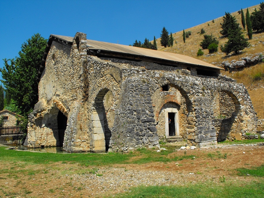 Battistero di San Giovanni  The spring flowing through the main chamber The spring flowing through the main chamber About a mile and a half north of the Certosa di San Lorenzo is the Battistero di San Giovanni in Fonte, a paleo-Christian baptistry unlike any other in the world--its baptismal waters come directly from the natural spring flowing through the building. The site was used worship a pagan nymph, but since the 4th century has been used for Evangelical baptisms. As a plus, there is a wonderful agriturismo B&B right next to the Battistero growing not only their own produce but having a fish farm growing trout--La Fonte Agristurismo. Sassano and its Valley of Orchids 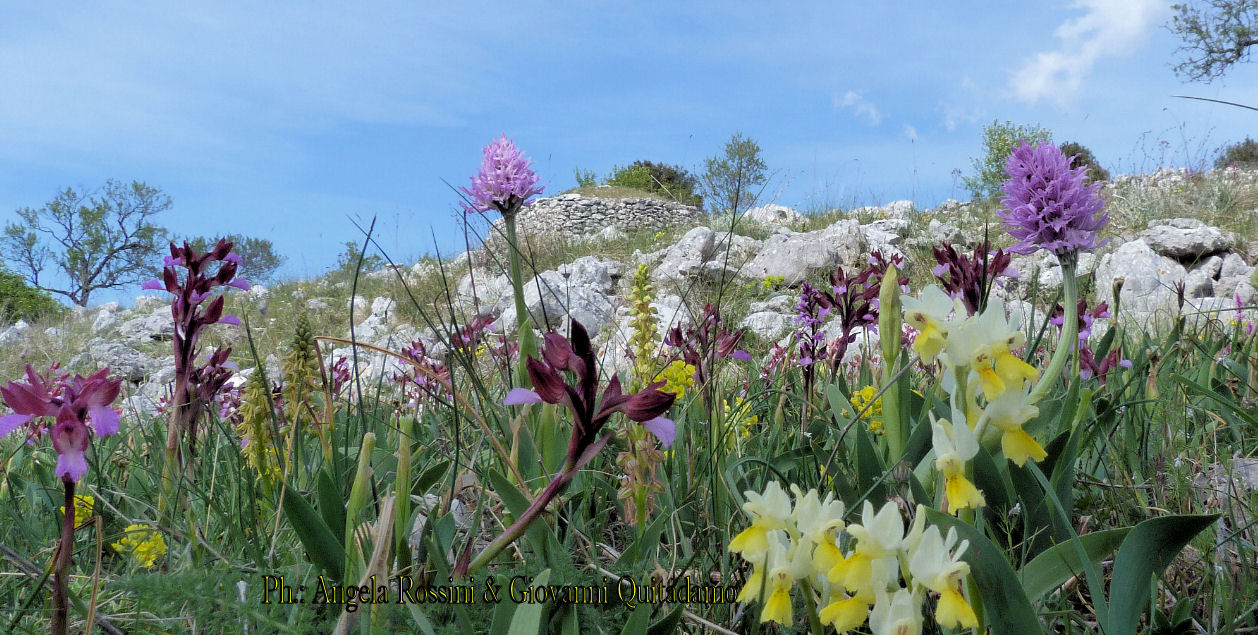 The Valley of Orchids (Valle delle Orchidee) is located in Sassano, right in the heart of the Vallo on the western slope opposite Padula. The orchids bloom from April to June, and even some varieties keep flowering until July. Within a 20 square mile area, you can observe 68 species of wild orchids plus 57 subspecies, 35 varieties and 24 hybrids. The entire Vallo actually boasts 254 species of wild orchids. Every year in May, Sassano celebrates the wild orchid with its Festival of the Orchids with free guided tours, tastings of local products, and regional folk music. 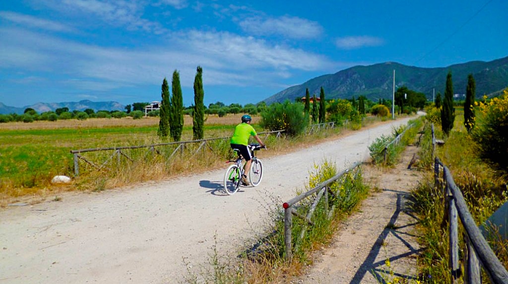 Typical dirt road and trekking path in the Vallo Teggiano 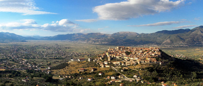 Teggiano The hilltown of Teggiano sitting over 2000 feet above sea level, on the eastern edge of the Vallo di Diano, has a history going back to the 4th century AD, originally an ancient Roman colony of Nero. The proof of its antiquity can be seen in an ancient Roman bridge and inscriptions in the town in Greek letters. You can think of Teggiano as a medieval museum which includes, The Castle of Sanseverino; the Cathedral with XIII century doors; the Church of Annunziata with its frescoes; the Church of St Angelo with a crypt from the year 1200; the Church of SS. Pietà (medieval cloister, frescoes and statues); the Diocesano Museum; and the Museum of Rural Civilization. 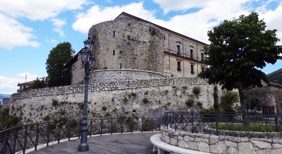 Castello Sanseverino 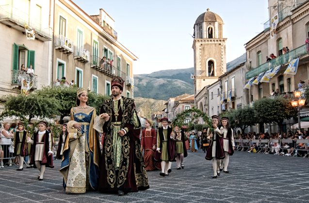 Renaissance festival Renaissance festival Sitting about 600 feet above the valley below, this is possibly one of the more beautiful hilltowns of the Vallo di Diano with several piazze and belvedere that afford majestic views of the valley and mountains surrounding the town. A very civilized town, there is even indoor parking at the top of the town! There are also incredibly wide piazze and viale--unusual for a small hilltown. It's a town for walking and taking in the wonderful architecture, such as the 15th century Norman fortress, Castello Sanseverino and its many churches and chapels. There are even some hidden gardens and many Italian style pot gardens. The feel is Renaissance, many of the houses having "Juliette balconies" and arched alleyways. There are often festivals and sagre in the town to enjoy throughout the year. And don't forget to get a viewpoint at night of the illuminated village from higher up on the mountain or from the valley below. Teggiano would be a practical place to stay for a few days to a week while exploring the rest of what the Vallo di Diano has to offer. If you decide to stay in the town, you can rent beautiful rooms in Castello Sanseverino or other apartments in the village for about $100 a night or less. I can imagine a one week stay in a Cilento coastal town like Santa Maria di Castellabate for exploring the coast or doing some boating, then another week in Teggiano while enjoying what the Vallo and surrounding mountains have to offer.
Atena Lucane 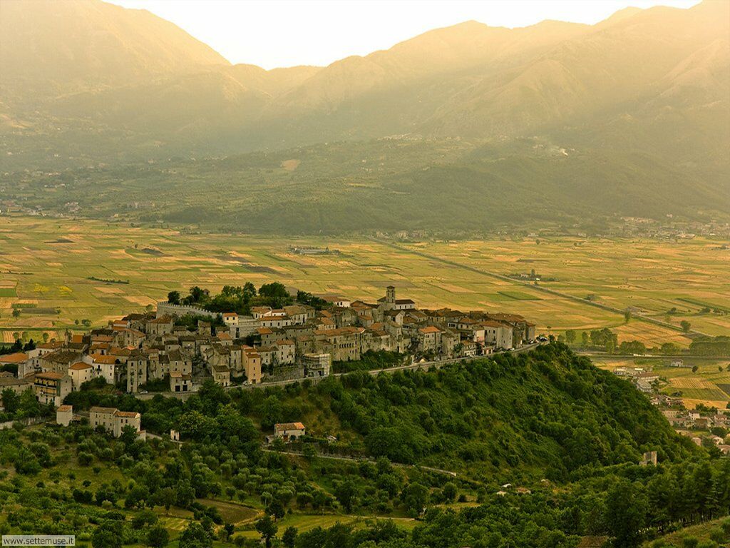 The Lucani were the native people living in the Vallo di Diano during the 6th and 3rd centuries BC. The megalithic walls in Atena Lucane date back to the 500 BC with both Greek and Roman dominance the 4th to 2nd centuries BC. Many historians claim this is the oldest settlement in the entire Vallo. This hilltown is tiny--only 1/4 mile wide but has fine views of the Vallo. There is a small archeological museum and a 12th century castle. The other reason to stop at this village is to do some trekking in the nearby Arenaccia valley where you will see mountain torrents, waterfalls and many caves. (Click to see a map of hiking paths in Atena Lucane). Polla 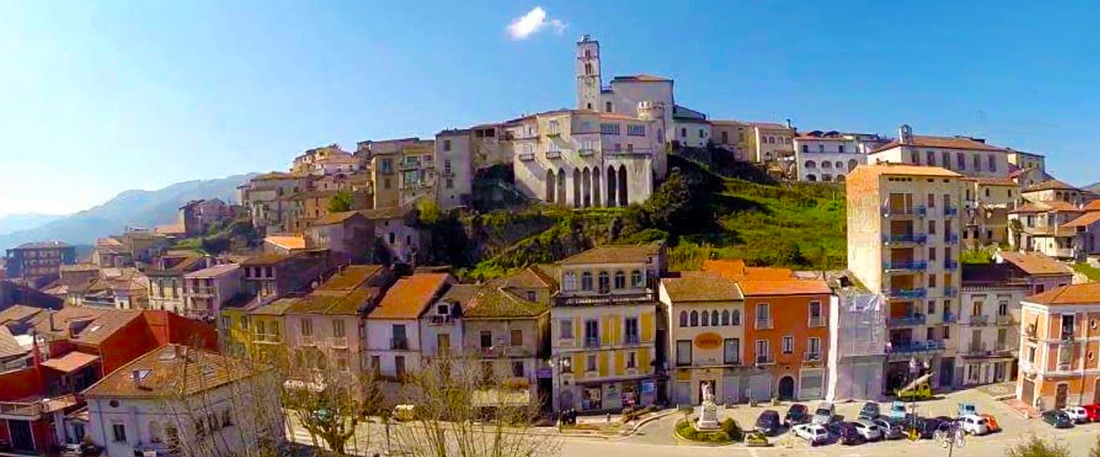 The medieval village of Polla can be enjoyed for its medieval historic center, its many churches, a 12th-century castle and the Franciscan monastery of Santuario di Sant'Antonio. It should be of particular interest to cavers and hiking enthusiasts thanks to the karst nature of the mountain above the town. The Grotta di Polla is located just below a tall rock cliff on the drive up Via delle Grotte, just below the Santuario. The cave's artifacts date it back to the stone and bronze ages. Polla is also a place for culinary pleasures, handcrafted folk costumes and their annual Pizza Festival. Copyright 2017, Jerry Finzi/Grand Voyage Italy - All Rights Reserved
 It's rare that Voyagers to Naples and the Amalfi Coast travel much further south past Salerno, but with its ancient Greek temples, rocky coast, picturesque port towns, sandy beaches, thousands of square miles of national park with its wild orchids, river rafting, mountain trekking and biking paths and even a ghost town or two, the Cilento Coast is a worthwhile destination. This isn't a very touristy area--aside from Italians. There won't be much English spoken in the villages and towns. If you come during the Ferragosto (August holiday), when most Italians are taking a month long vacation, the sandy beaches will be crowded with Italian families and in some areas, wall to wall beach umbrellas. But most other times of the year, the Cilento Coast is laid back and definitely not on the tourist radar although there are miles and miles of sandy beaches and their beach towns along the coast. This is Middle Class Italy at its best. You will see a mix of quaint towns, abandoned buildings, built-up beach resorts, construction projects seemingly at a standstill, rustic cabins and trailer camping grounds, Greek ruins, fantastic surprisingly great family ristorante, cozy and flowery B&Bs, Norman and Saracen watch towers, hilltowns and mostly fishing boats in place of luxury yachts. The climate is mild in the Cilento, even at the shoulders of the tourist season. Early spring and late fall will still have temperatures in the mid-sixties during the day--cold for Italians, but fine for the rest of us. And even in November, the rainy season is not really that rainy--about 9 days per month on average. The best news... even in August, the historic averages are in the mid eighties, due to both the sea breezes and the cool air coming down from the mountains. The sunsets are also better on the Cilento because the sun sets over the sea, unlike on the Amalfi Coast where the sun sets over the mountains in the direction of Capri. And if you love mountain biking, SCUBA diving, fishing, trekking and exploring grottoes and caverns, then the Cilento is a place to explore... Paestum: Greek Temples Older than Ancient Rome 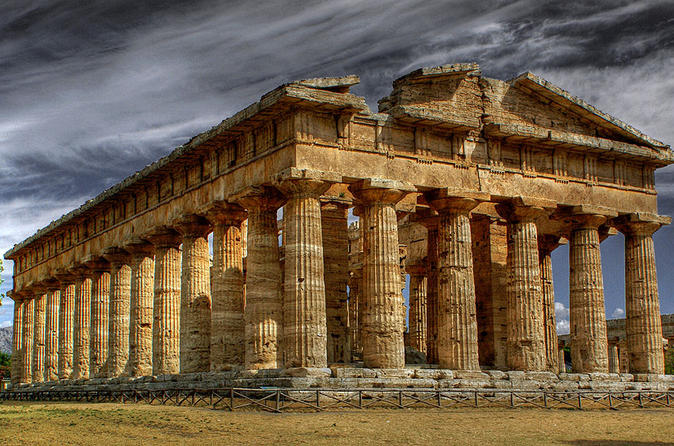 Paestum (originally named as Poseidonia, honoring the god Poseidon) was founded by the Greek Achaeans around 600 BC as a major city and trading port with a system of roads, temples, and defensive walls. It was an attractive site due to its fertile fields, sea port and access to the inland mountains. Paestum is a day trip from the Amalfi Coast, with tourist buses dropping off the throngs of people in late morning, but Voyagers to the Cilento Coast can consider it as their first stop to discover its three well preserved Greek temples, archeological site and museum.  Tomb of the Diver Tomb of the Diver The Temple of Hera is oldest, built in 550 BC. It has 9 Doric columns on each facade and 18 along each side. The Temple of Athena was built around 500 BC. It has outer Doric columns and Ionic columns inside. It is 6 columns wide by 13 long. The Doric Temple of Hera II is the youngest, built in 460 BC and is also the best preserved. It is six columns wide by fourteen long. By 273 AD, the Romans took control and renamed it Paestum. The workaday beach town of Paestum is also worth a stop for a pizza with mozzarella di bufala or for a walk on its beach. Mozzarella di Bufala 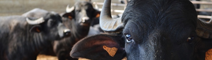 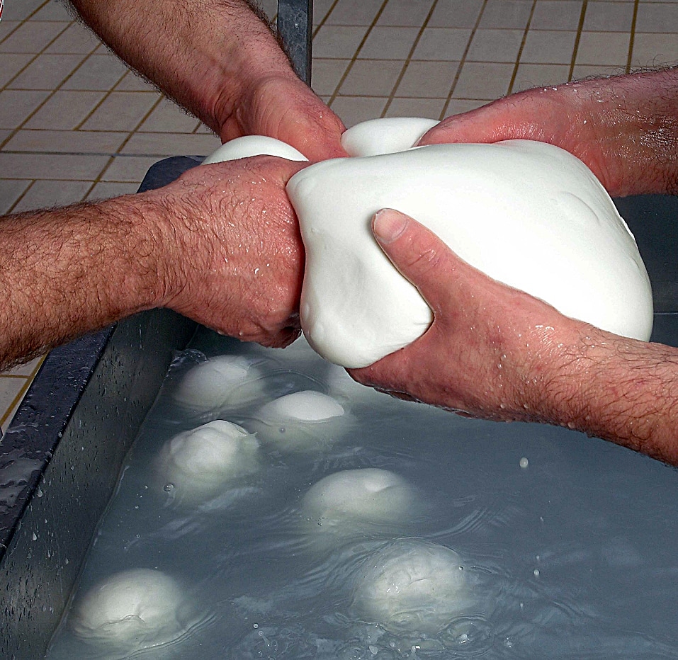 It takes two to stretch and pull balls of mozzarella di bufala in extremely hot water It takes two to stretch and pull balls of mozzarella di bufala in extremely hot water The most famous and important food product of the area, especially in the towns of Battipaglia, Eboli and Paestum is by far the Mozzarella di Bufala. There is no cow's milk used in this region for mozzarella. The milk used is from buffalo, or rather, the breed of water buffalo raised in the Campania region and the resulting cheese is a DOP protected product. Fully 90% of the mozzarella di bufala is produced in this region. Tours of a buffalo farm are possible, but two good ones to check out are Taverna Penta and Tenuta Vannulo. The buffalo are treated well here... they even have self-service massage machines that the buffalo can go to whenever then need a little spa treatment. When trekking in the high mountains of the Cilento you will probably come across herds of buffalo grazing--a beautiful sight. The amazing taste of Mozzarella di Bufala--as well as their meat (very popular here)--is a testament to their fine treatment. 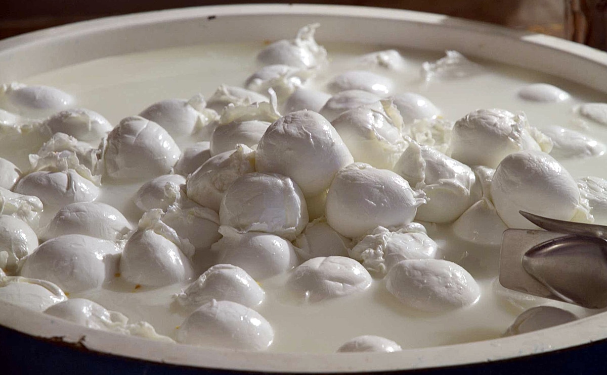 Flying in Cilento: Zip-Line Adventure at Trentinara 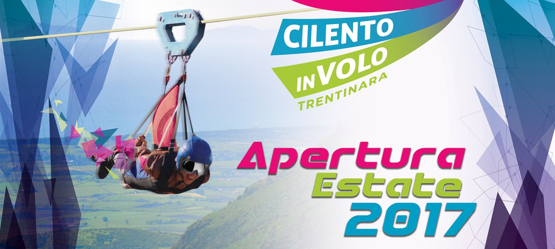
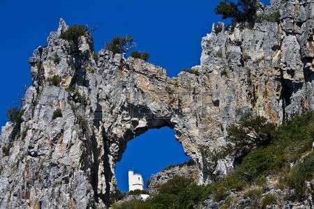
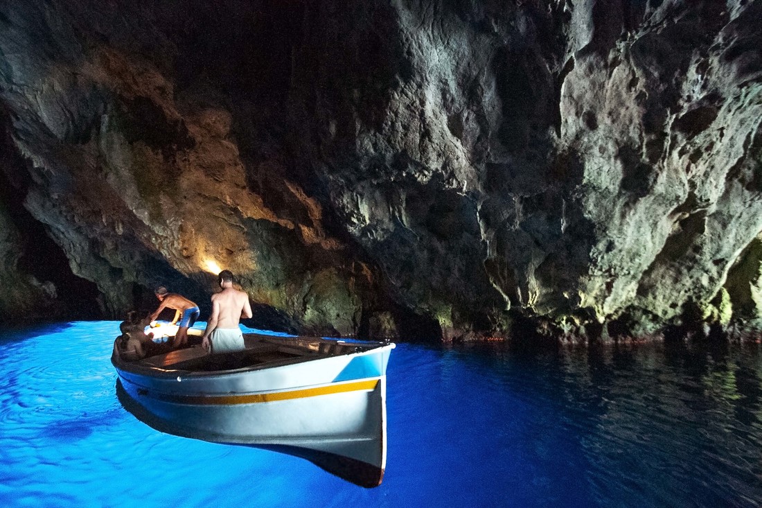
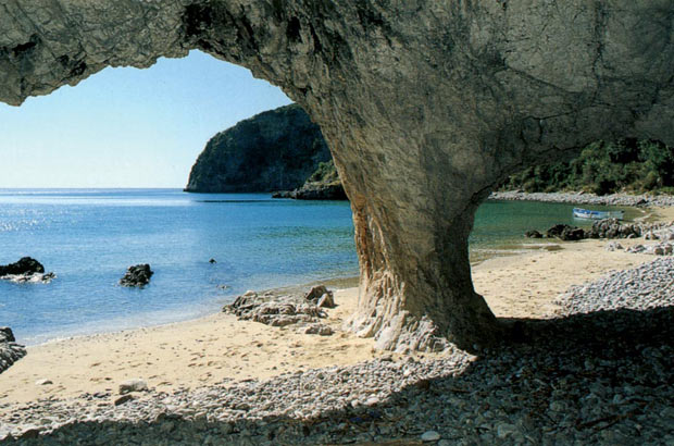
Coastal Towns Worth a Visit 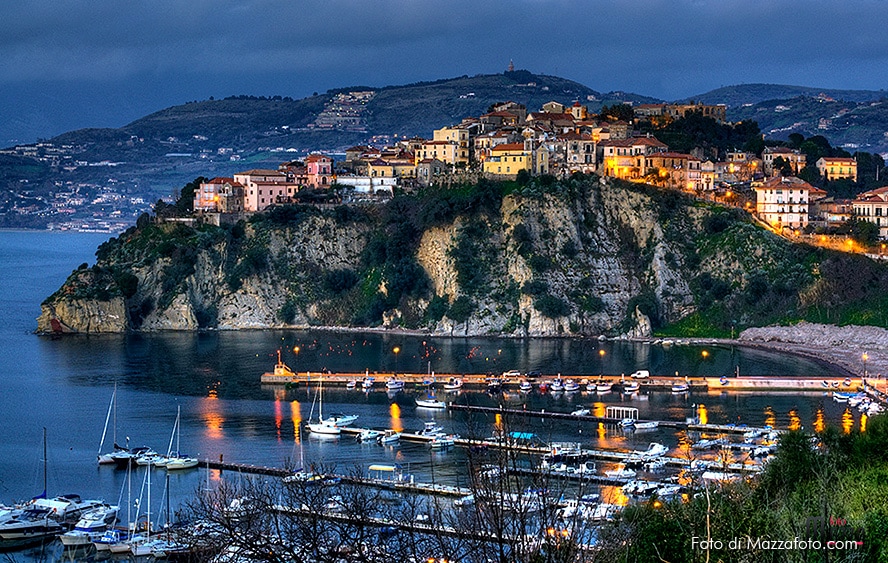 Agropoli at dusk Agropoli's history is varied and interesting, from the neolithic people living in the surrounding hills, hunting and fishing, to the indigenous people that created a more stable settlement before the Greeks came around 600 BC and settled in nearby Positania (Paestum). The Greeks use the large bay (since silted up) and river for fishing and trading. By the 1st century BC, Romans controlled the settlement and renamed it Ercola to honor Hercules. The Byzantines took over control in the 5th century BC and the Normans built a fortress castle to ward off attacks from the Turks. As late as the 1800s, even the French controlled the port town. 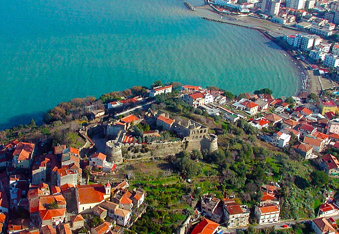 Il Castello Il Castello Only one hour from Salerno by car, Agropoli is part of the National Park of Cilento and Valley of Diano and is a UNESCO World Heritage site. It's a romantic town, especially at night, virtually every balcony has a great view of the sea, fig trees and the mountains. Worth a visit is its castle which crowns the medieval village (borgo), cobbled streets and its wonderful churches. There are obvious influences of the Saracens, the Turks, Byzantines, the Romans and the Greeks in its architecture, food and culture. In summer there are medieval festivals with colorful costumes in the old town and flowers just about everywhere. Agropoli would be a very good choice as a hub for a longer stay to explore other areas of the Cilento. 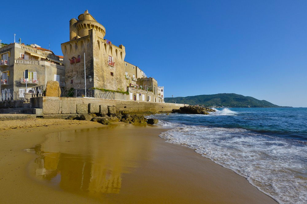 Torre Perotti, Santa Maria di Castellabate When we talk about visiting Castellabate, we are really talking about three towns... The old town of Castellabate high up on the hill with magnificent views of the broad gulf, San Marco, the picturesque small port village on the southern edge of the bay, and the larger Santa Maria di Castellabate, arguably the best resort town on the Cilento Coast. San Marco offers fine hotels, a natural walking path to a rocky "la Grotta" bathing environment, and its small pleasure boat harbor. The hill top medieval village of Castellabate is a UNESCO treasure, with amazing views of the gulf between Punta Licosa and Punta Tresino (the natural sea park). Perhaps its best treasures are its castle and the Papal cathedral. During summer and fall there are medieval festivals with celebrants in colorful costumes. This historic village is positively magical at night. Sitting on the east coast of the blunt Cilento peninsula, Santa Maria di Castellabate, is one of the most picture perfect beach towns on the entire Cilento Coast. It has several sandy beaches frequented by families, not movie stars. Perhaps its best feature is its promenade along the port, a great place for an early evening passeggiata. There are also a good variety of restaurants and cafes to choose from. This is definitely a place to stay for a while or as a hub to explore the rest of the Cilento. 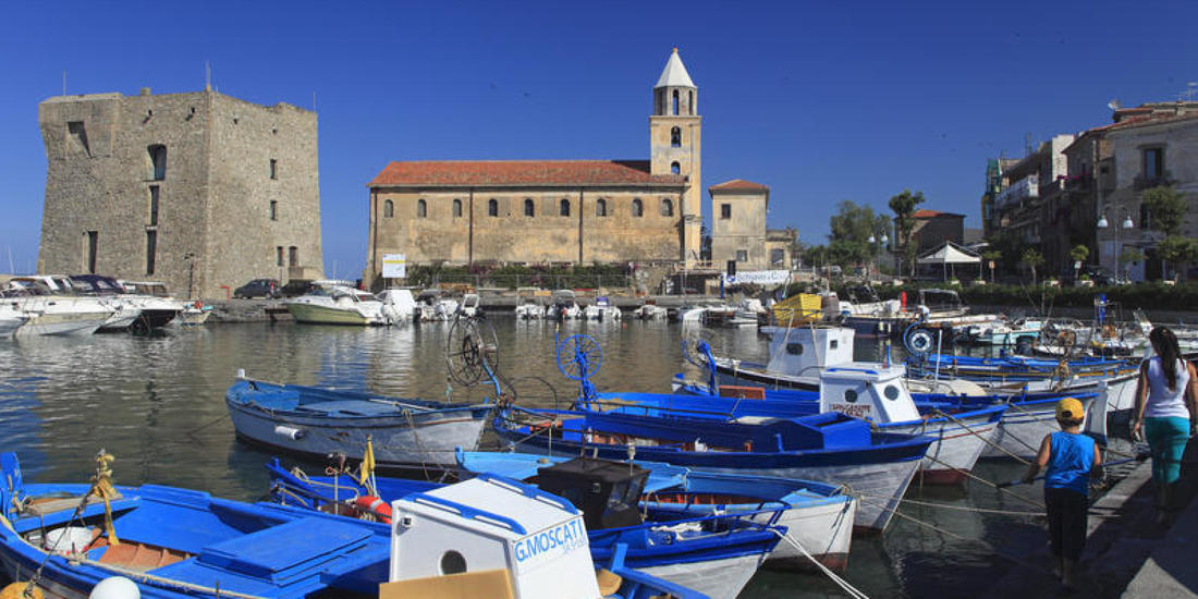 The harbor at Acciaroli Acciaroli has the honor of having over 300 residents over the age of 100, mostly due to its laid back lifestyle and healthy Mediterranean diet. It is sleepy seaside village with a scenic seaside walkway and a charming old town. The crusty details of the aging architecture is a photographer's dream. An authentic fishing port, you will see mostly fishing boats with the trawl nets and sailboats docked in the small harbor. There is also a long sandy beach with some of the cleanest water imaginable. It's possible that during your stay you won't meet anyone but locals. Earnest Hemingway wrote the Old Man and the Sea after spending time in Acciaroli, his "old man" character being drawn from a fisherman he befriended while there. 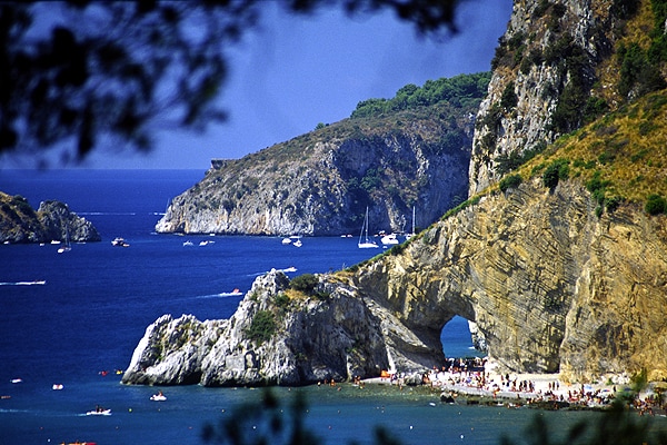 The Arch of Palinuro 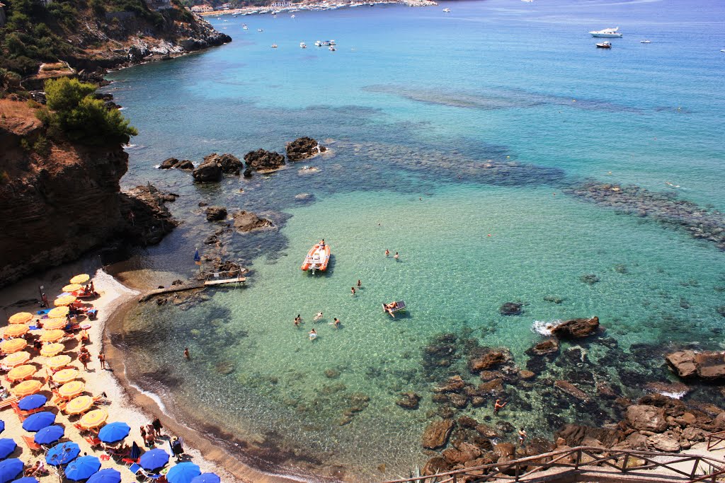 One of the several tidepool beaches in the area One of the several tidepool beaches in the area Palinuro is the southernmost town on the Cilento Coast I am profiling... but more than just the town, I am recommending Capo Palinuro and the rugged area and shoreline surrounding this rather typical holiday and camping town. This rugged promontory juts out into the sea with many crags, cliffs, islets, sea grottoes and even several natural arches. If you like things rugged or camp with a caravan (we call them a Third Wheel here in the States) then this town is for you. Otherwise, you could rent a holiday villa and explore the area... renting boats, SCUBA diving, mountain biking, hiking, bird watching and more. Capo Palinuro is a naturalist's dream, with many sentieri (hiking paths) throughout the peninsula that can be used to observe flora and fauna--there are thousands of indigenous species for botanists, birdwatchers and casual nature lovers. Even the beaches in the village of Palinuro are of interest--they are located in rocky tide pools 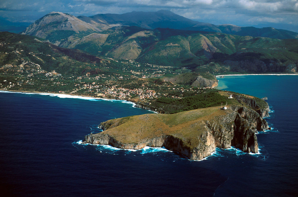 Capo Palinuro  Palinuro sea otters Palinuro sea otters hatever you do, try not to miss the Blue Grotto, the Arch of Palinuro, or just rent a boat at the marina and discover the many other sea grottoes that dot the Capo. The really amazing thing about the Capo is that the distances between sites are very low. A circumnavigation of the cape by rental boat is roughly 3 miles one way--a very doable and amazing boating adventure for a single day's boat rental where you will experience monumental cliffs, snorkel in a sea grotto, swim in unbelievably clear waters, sun yourselves on pristine sandy beaches and perhaps come upon a Palinuro Sea Otter. 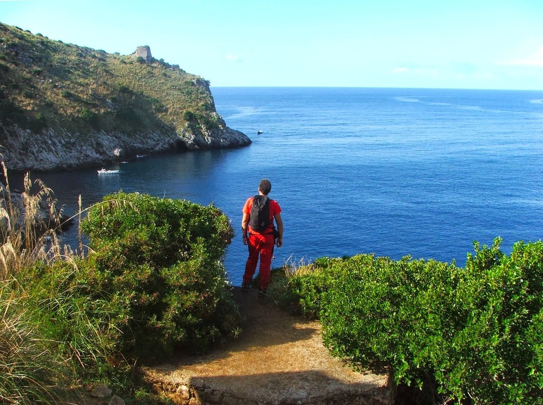 A sientiero (path) on the Capo Also, hiking loop trails on the cape are fairly short distances, for instance, the longest loop trail that takes you from the village of Porto up and around the Capo and back is a little over 3 miles. Still, these trails do involve a change in elevation of about 300 feet, so you need to be fit to enjoy them. Fun Fact: The Arch of Palinuro can be seen in 1960s Hercules films and Jason & the Argonauts.
I suggest ending your coastal Voyage of the Cilento Coast at Palinuro simply because most of the towns further to the south are very large beach towns with kitchey tourist shops and wall to wall beach umbrellas from larger hotels. Starting at the holiday town of Marina di Camerota to the bustling town of Sapri set in its deep cove harbor (the last coast town in the Cilento region) the feeling is less and less laid back and more holiday town. I will mention, that for campers, there is a nearly three mile strand of straight sandy beach that looks back on the Capo di Palinuro stretching from the Fiume Mingardo river to Marina di Camerota with several camp/caravan venues, but during the high season these might be booked solid by Italian holiday campers. Leaving the Palinuro area, I'd suggest driving up toward the hilltown of Senza, located near the southern starting point of the Vallo di Diano... (see MAP) --Jerry Finzi Copyright 2017, Jerry Finzi/Grand Voyage Italy - All Rights Reserved
|

Categories
All
Archives
May 2023
|


 RSS Feed